Friday, December 17, 2010

The Weather is Good

*********************************
NEW and exciting!
"Jacob's Tails . . . (Back-to-the-Land)"
is now in E-Book formats
and can be downloaded at
*********************************
Double Click on photos to enlarge
*********************************
Did you know the weather in Yuma is reputed to be the best in the USA? Oh, yes, we are still here – in Yuma and at the Escapees Kofa Ko-op Park.

How come we’re still here?

Good question!

I was surprised too when I went to pay our rent – Holy Cow – this is our fifth week here – we never stay in one place that long. Oh, well we may as well stick it out for the holidays.

My legacy to the park is the two creative workshops I did. Now someone else can take over.

I was asked to do a feature article on the Canyons for the RV Lifestyles Mag. and got it off to them last week. We won't see them until next year, but that's okay.

We have caught up with some of the folks we couldn’t find in Laughlin and reconnected with a bunch of old friends. We have found more folks we hope become as good friends as the old ones. That does sounds schmaltzy, doesn’t it? Oh well, you know what I mean.

We’re on the south edge of town surrounded by citrus orchards (and wanna be housing developments that have been abandoned because of the economy). Did you know it is a felony in Arizona pick fruit or vegetables? So, we’re not going to do that.


The last couple of mornings we woke up to the rat-a-tat sounds coming from the military base just over the hill.

Oh, talking about waking up (or nor waking up) – apparently last week there was an earthquake and we slept right through it. It was a magnitude of 4.9 and centered about 35 miles away in Mexico. I think that was the first earthquake I’ve ever experienced and I didn’t even know that it happened until someone told me.


By now, we probably know Yuma better than we know Lethbridge (our home address). We seem to spend a lot more time exploring.

Our first new venture was off to the Saihati Camel Farm. It is a small family operation started about 20 years ago by a woman from Oregon and her husband, who was from Saudi Arabia. He wanted to do something that would remind him of home, so he started raising Arabian camels (the camels with one hump). Actually, Arizona has a long history of relationships with camels. In the mid-1850s, camels were used as beasts of burden on an expedition to survey a road from Fort Defiance, New Mexico, to Fort Yuma, Arizona, and then out to the Pacific coast. There were 25 camels on that trek.

The farm is not that well laid out but has a menagerie of odd and different animals. (http://www.rvwest.com/journeys/rvtales/see_the_exotic )


Jacob Four-Horned Sheep


Zebra-Donkey


One hump Camel


Funny chicken


Big horns!


We had never been past El Centro on Interstate Highway #8, so one day we just took off in the car. Fred had a route he wanted to go in his mind but he forgot to tell me. I was looking for a Visitor Information Center. Oops, I forgot California is an hour earlier than Arizona so that Center wasn’t open yet. On we went – ah, a Visitor Information sign – let’s find it.

Oh, my – no Center but we did find a new Casino.

“Oh, $5.00 free-play for new players and $5.00 free-play for seniors.”

We could do that. We walked out half an hour later with about 30 extra dollars.

Back onto the highway I saw an interesting looking road (S1) up to the Cleveland National Forest.

Holy Crap! Back and forth; round and round; up and up we went. The first sign said elevation 1000 feet; around four more switch-backs in the road: elevation 2000 feet – rocks, rocks and more rocks.


We went up 7000 feet to the resort-type settlement at the top of Laguna Mountain.


And just as quickly we wound down the other side and into the desert again.


Our next stop is going to be the desert probably Gunsight BLM down by Why.

We have never spent much time around Tucson – who knows!!

Monday, November 29, 2010

Old Routines Never Die

Saturday, November-06-10

When we left Canyon de Chelly, we did a quick visit to the Petrified Forest NP and we spent the chilly night in Williams, AZ. In the morning, I & A went over to the Grand Canyon and we set off to Laughlin.

To our surprise, there were very few RV’ers at the Tropicana (where we usually park and find all the folks we have met over the years). The casino started charging to stay there and people have just moved on. Mya (one of the ole’ time friends) was over at another casino. We spent one night there and then moved down to the AVI (no one there either) for about a week.

Nov. 6th found us sitting at Hi Jolly BLM in Quartzsite, AZ, again. I & A arrived just a few minutes after we did. We parked at our usual spot over by the Wash. This is really old routine, by now. We’ve tried other locations, but always seem to come back here. We like it! Fred can scrutinize the comings and goings along the road and I can scrutinize the comings and goings of the birds and animals in the wash.

I watched the hummingbirds feed from our little red feeder – one female who keeps coming back and a male who just showed up. They land on one of the two tiny perches that stick out from the side of the feeder. They then stick their long thin beaks into centre of the little yellow plastic flowers some ingenious Chinese designer stuck onto the base. I’m not sure if it is the same female but one seems to arrive to feed about every three to four minutes but the male only comes around occasionally. Every once in a while they seem to get into an argument but that’s not unlike most other domestic couples we know.

There is a family of California Quail that live in the wash. Dad comes out first and flies up onto a branch while Mom and the brood waddle up the wash to find food and waddle back again. They seem to do this every morning and every evening. I’m yet to find out where they nest but I will, over time. We’ll probably be here for a couple of weeks.

I managed to break the Broadband2Go internet stick so we were restricted to the Library or Senior Centre again until I got another one – what a pain!!

Sunday, November-28-10

Time flies by when you are either having fun, or getting older (one or the other or both) and here it is nearing the end of November.

Quartzsite was Quartzsite was Quartzsite was Quartzsite – We stayed our 14 days on the Hi Jolly BLM. That gave us time to get a new internet stick; dump once at the Pit Stop (an interesting business that is set up specifically for RVers to dump their waste water and flush out the tanks; fill the fresh water tank with good water; and have the propane tanks filled) and move on. All the prices here seem to have gone up since last year – RV parking at the Pit Stop was $12 last year and $20 this year. We’ve noticed an increase in food, as well. The General Store here has a real butcher shop and still sells the best meat around.

The price of fuel always goes up at this time of the year, so it is hard to tell if the price is higher because it’s Snowbird Season or because of the economy.

We did manage to go to a fund-raising dinner for Cecelia’s Garden at the Quartzsite community center (QIA). Cecelia was Paul (the fellow who owns the Oasis bookstore and wears a thong) and Joanne’s daughter who died in the mid 90’s.

Paul’s alter-ego (Sweet pea) came out – he plays an incredible boogie-woogie piano and is, in fact, quite shy.

Cecelia was born in Toronto and lived for seven years. She had been the smallest baby born in Canada (1.25 pounds). Over the years in Quartzsite, she captured the hearts of many who met her. In her memory, Cecelia's Rainbow Garden is set on 8 acres of desert donated by the BLM on the edge of Quartzsite. It seems the whole community has become involved. They sell plots and people create garden sites and memorials in whatever way they choose. They encourage people to donate something live so there are a lot of the unusual cacti, trees and shrubs that don't ordinarily grow there.


There really was not much going on in Quartzsite so we left to go down to Yuma and Algodones and expect to go back later in the Season. Our plan was to check into our usual spot in The Foothills (Yuma) but Sallee and John were busy that week and Bob (our on-site landlord) was not there, so we decided to check into the Escapees Park, Kofa Ko-op for the week and here we still are.

This is not the same up-tight park we encountered six years ago when we stayed here and Fred got sick and we couldn’t find anyone to help us. The atmosphere has changed . . . they seem to appreciate visitors as opposed to resenting their intrusion (that’s the way it felt before). We already knew a number of folks and there are a lot of Canadians here. The swimming pool is nice and we’ve already been in the hot tub twice and I’m doing a Writers Workshop next week.

We went down to Algodones (Mexico) last week and Fred got his new glasses - not only can he now see (I was beginning to be a bit concerned with him driving) he looks kind of spiffy too.
I got a great hair-cut - as good as the one at Casa Grande last year - and another purse - like I need another one (?) - But it was $10.00 and I couldn't resist. We got some more vanilla and those wonderful chocolates.

Sallee and John have introduced us to the $10.00 seniors’ free play at the casino. It looks like we may stay here at least until after Fred’s birthday.

They say learning is life-long and I certainly have learned a lot about myself over this past month. I am extremely independent. I like to do what I like to do when I want to do it!

I can get very bitchy if I feel someone expects me to do something I don’t want to do or I feel is trying to take advantage of me. I almost got to the point that I didn’t even like myself.

Thursday, October 28, 2010

Starting Out with NO Plans

*********************************
Double Click on photos to enlarge
********************************
We voted in our Municipal election; got our flu shots; paid off the Protection Money for our Medical Travel Insurance; and got out of town by Oct. 18th!

Where?

The only thing we planned was to meet Ina and Allan (folks from the Nanaimo Park we stayed in that Vancouver Island winter) in Butte, MT and decide from there.

Avoiding the Salt Lake City traffic fiasco had been desirable but I & A wanted to do the Canyon thing so our non-planned adventure changed direction.

Off to Utah and the Canyon area; the Arches around Moab, UT; Canyon de Chelly, AZ; and so forth. This area of the States gives you a taste of what happens after millions and millions of years of climate change and is a paradise for geology and archaeology enthusiasts alike.

Arches National Park is just north of Moab, UT. I do keep forgetting how commercial some of these places can be. Moab is another tourist town. From what I could see, it caters to those "Canyoneer" types - young, VERY physically fit – that hike, tent, buy L. L. Bean clothes and equipment, drink Cappuccino, and frequent expensive eating places. Beyond that, the Arches (Arches National Park) is another natural phenomena.

Arches5-crop

Apparently, there are massive salt beds underneath the park that resulted from evaporation of the sea water that covered the area about 300 millions years ago. As the climate and natural forces changed, much of the debris was compressed into rock and the salt layer shifted, buckled, liquefied and reposited itself, thrusting some of the rock up into domes and down in cavities. Underground faults resulted in vertical cracks. The movement of the salt layers and surface erosion helps create the environment we see.

Arches2010 037

Arches2010 031

Arches2010 024

Gigantic tall, narrow phallic towers grow up from nowhere and dot the landscape where you least expect them. The process continues . . . you can just imagine all the power and forces that must have existed to create all the waves, windows (holes) and arches.

Arches2010 011

The Four Corners – is where Utah, Colorado, Arizona and New Mexico meet. A rather unspectacular site: as one fellow put it “it was hardly worth the cost of the gas to get there”, but then you could say that you had been there.

Arches2010 024 (2) At the Arches NP, I had watched a gal from Europe photograph her silver teddy bear in front of the various formations and thought it looked like a fun idea so Nikita (my black Russian seal fur teddy bear) took centre stage at the Four Corners. That gave it a bit more interest. They are trying to liven up the site and are building structures to house venders all along the outside the perimeter of the monument.

FourCorners (3)

FourCorners (4)

Now Canyon de Chelly National Monument is a totally different story. I must admit it comes in a very close second to Zion, my most favourite canyon area.

It is unique in that, even though it is a National Park, it is on Navajo lands and very much controlled by this First Peoples Nation.

Canyon de Chelly 038

There are no fees to enter the park or stay at the campground. They call Canyon de Chelly National Park a labyrinth of canyons. Canyon del Muerto is the north leg and Canyon de Chelly is the south leg of the National Monument and each branches out into smaller, less significant canyons. You can tour along the North and the South Rims unescorted but you must have a Native guide to travel down into the canyon or explore any of the ruins except the White House. There are many Overlook (lookout) sites situated on both rims to view the canyons below and the ruins across on the other side of the rim.Canyon de Chelly 035

Canyon de Chelly 030

It is not difficult to pick out the various geological layering in the canyon. They have found plant fossils that give evidence that about 280 million years ago this area was subtropical. Over the next few hundred thousand years the climate changed from subtropical to desert thus creating the de Chelly sandstone, then the conglomerate layers. Massive shifts in the earth's crust along with the forces of mountain building, stream cutting, wind and erosion resulted in canyons we see today.

Canyon de Chelly 020 (2)

The reminiscent of campsites date back to between 2500 and 200 B.C. but the farming and communities and then villages began to appear around 200 B.C. and dispersed after 1300 A.D. Even so, there are still Navajo who live and farm in the Canyon today.

WhiteHouse-Cliff Dwellings-Canyon de Chelly (3)

So many of the ruins are built into the cliffs, they say for defence as well as protection. The only trail you are allowed on without a guide is from the top of the South Rim to the White House Ruins. They think the first structures were constructed by the Anasazi, a farming people who preceded the Pueblo, Hopi and Navajo (also connected to the Athabascans) around 1040 A.D from a rather crude masonry style called Kayenta.

The cliff dwellings were built first and then the canyon floor structures with rooms that were built up to reach within 4 feet of the upper level. At its prime, this community contained as many as 80 rooms inhabited by 10 to 12 families . . . from 50 to 60 people.

Evidence indicates that the "kivas" (circular rooms) were used for religious ceremonies similar to those Pueblo, Hopi and Navajo of today.

Spider Rock-Canyon de Chelly (7) FaceRockCanyon de Chelly

Spider Rock rises about 800 feet above the surface at the junction of Canyon de Chelly and Monument Canyon. a lesser spiral to the west is called the Face Rock.

A Navajo story tells how Face Rock would inform the Spider Woman (a holy woman who lived on top of the Spider Rock) about naughty children. She would then carry the children to the top of the Rock. The story goes that the white band near to top of the taller of the Spider Rock spirals represents the bones of the bad children eaten by the Spider Woman.

The Navajo have many wonderful stories.

Friday, September 17, 2010

This is What We’ve Been Saving for . . .

NEW and exciting!
"Jacob's Tails . . . (Back-to-the-Land)"
is now in E-Book formats
and can be downloaded at
Smashwords
*********************************
Double Click on photos to enlarge
********************************
We’re looking at the Medical Travel Insurance for the winter . . . as a good friend would say “Holy Crap”. I wonder what it would be if we had any real medical issues?

In the meantime, summer weather has been rather non-existent. We exceeded 30 C (90 F) twice all summer – and now it’s gone. The coulees across the river are usually dry and brown by August and now it is mid-September and they are still green.

I managed to convert "Jacob's Tails" to an e-pub and it should be in Smashwords Premium Catalogue in the next few days. That means Amazon, Chapters/Indigo, Barnes and Noble, Borders, etc will have the e-pub available to their customers in about a half-a-dozen e-book formats. In the meantime an e book copy that you can read on your computer can be downloaded at Smashwords!

Cool, eh?

The Book-signing­ at Save-on-Foods went well and I sold 10 books and RV West is continuing my E-column. They did put my Snowbirding 101 piece in the most recent magazine, as well.

After our trip along the Icefields Parkway, the summer fell into its usual pattern. We did our Calgary trip where I got my IKEA fix (I spent $6.25) and had short visits with friends (we need to go again for longer visits). I did get some great shots of the canola fields and an urban Calgary bunny.


Sheila and Chuck (travel-buds) came down from Wetaskiwin for the Taber Corn Festival. Unfortunately, the weather has been so rainy and cold, the corn was really not ready . . . but we had fun anyway . . . we caught some young fellas on motor-bike jumping through the air


Some unique petting animals


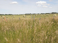
And some handsome hay fields and a ferocious dinosaur


Lethbridge and our particular location never ceases to amaze me . . . the coulees – the bridge . . . our view . . . and the magnificent sunsets.


What now?! I know we’ve been saving all our lives but I never thought it would be to pay for the Medical Insurance we need to travel south for the winter . . . but the planning begins!!

Monday, July 19, 2010

Summer Travels

Oh, take a look at the Elk Valley article that RV Lifestyle Magazine put up on-line:( http://www.rvlifemag-digital.com/rvlifestyle/2010v39iss1/#pg18 )

**********************************

Double Click on photos to enlarge

********************************

Please remind me how different it is travelling in July and August. In the winter we park in one place and take day-trips. Summer travel involves going from one campground to another almost nightly.

Most of our neighbours were family vacationers and overseas tourists in rented RV’s. Certainly more people than I am used to.

On the other hand, we did take this as an opportunity to find some of those higher elevation and alpine wildflowers and learn how to use the macro on the camera . . . AND the scenery along the Icefields Parkway is absolutely spectacular!

We spent a couple of great days visiting with winter travel buddies in Wetaskiwin (about 7 hours north) and then took the Yellowhead Highway – destination – Prince George, BC. At Prince George we were going to decide whether to go further west or go north up to the Yukon. The first overnight was to be McBride, BC but we wanted to stop at Hinton to stock up and get gas before we hit BC and the Sales Tax (BC stands for bring cash, ya’ know).

Hinton was the first place we unhooked the tow car (Saturn) because it got complicated and we couldn’t find the Visitor Information Centre and so on; then again when we took a bad-d-d road to what looked like a great lake-side camping place; and finally, at the Lucerne Campground (just east of Mount Robson) where we stayed for a few days.

Mount Robson is the highest peak in the Canadian Rocky Mountains (12973ft.) and perpetually hidden from view by mist and clouds (One statistic I saw was that you could see the peak about fourteen days during the year). We were lucky and managed to see and get a photo of the peak not all hidden by clouds and mist. (http://www.peakfinder.com/peakfinder.asp?Peakname=Mount+Robson)

Wildflower photo-taking time!!

Goat’s Beard


Indian Paintbrush


Wild Roses


Cutleaf Daisy


Dwarf Dogwood


We got to Prince George and had to make up our minds which way to go. It was cold and wet and Fred was not feeling too good so the decision was to head back to Jasper and the Icefields Parkway . . . maybe we could find summer . . . at least we could get back to Alberta just in case Fred needed to see a doctor.

Even if you are just travelling through, there’s a charge to travel the parkway . . . BUT having said that, it can take days to travel the 150 miles from Jasper to Lake Louise if you want to visit all the sites. We did our share!!

Athabasca Falls


Note the rainbow


Victoria Glacier


Peyto Lake


Weeping Wall


It does feel strange to be surrounded by ice and snow in the middle of July!

We managed to get an appointment with the doctor on Monday, an ultra-sound on Tuesday and confirmation what it wasn’t on Wednesday.

Next step is to find out what it is but most of the worrying is gone.