Friday, November 16, 2012

New Mexico: The Land of Enchantment 2

There is something about the camaraderie in a traditional Escapees RV Park and The Ranch is one of the few that follow that tradition. A welcoming bell rings each time visitors come in. Folks seem to come out of nowhere to welcome the new visitors. Hugs are the greeting for many and others just welcome the newcomers with a smile, a nod or a handshake. The only drawback of The Ranch is that it sits in the middle of nowhere between Roswell and Carlsbad but the folks could not have been more welcoming and congenial. We reconnected with people we had met before and connected with others we will probably meet again in our travels as we explored the area.
Carlsbad Caverns
The first caverns we toured were the Mitchell Caverns in the Mohave Desert over 10 years ago. They felt small and intimate as the walls seemed to close in. The strongest memory is the sense of darkness. Without the guide’s light, it was impossible to even see your hand in front of you.

In contrast, the Carlsbad Caverns are humongous!
We toured the Big Room. that is supposed to take about one and a half hours – Huh! After over two hours, we were all pooped out but it is spectacular.
The first thought through my mind was “it seemed a lot like the Grande Canyon “ – just that huge! Then I discovered that Will Rogers described it as the Grand Canyon with a roof on it - I understand why (except you are 750 ft. underground).
When I Googled the Big Room in the Carlsbad Caverns it came up with the funniest explanation of the size that I have ever read so I decided to include it.
The Atlas of Great Caves of the World by Courbon, Chabert, and Bosted & Lindsley published in 1989 states that the floor area of the Big Room in Carlsbad Cavern is 33,210 square meters. 33,210 sq. meters equals approximately 357,480 sq. ft. A football field is 360 feet long (including the end zones) by 160 feet wide or equal to 57,600 sq. ft. By dividing 57,600 sq. ft. into 357,480 sq. ft., you roughly get that 6.2 football fields would fit into the Big Room. In acres, one acre is equal to 4,840 sq. yards or 43,560 sq. feet. Divide 43,560 sq. ft into 357,480 sq. ft. and we find that the Big Room is 8.2 acres in size (more or less).

Needless to say - it is BIG! – And old!
It’s estimated the caves started forming about 25 million years ago. The acid percolating up from below and rainwater and snowmelt draining down from above form small mineral deposits called speleothems. Growths from the roof downward are known as stalactites. Additionally, water on the floor of the caverns can contain carbonic acid and generate mineral deposits by evaporation. Growths from the floor upward are known as stalagmites. Other speleothems have names that reflect their shapes: columns, soda straws, draperies, helictites, and popcorn and formation carry names such as: Bottomless Pit, Giant Dome, Rock of Ages, and Painted Grotto.

Path through the Big Room


Stalagmites
Stalactites


Ladder down to the Bottomless Pit

Saturday, November 10, 2012

New Mexico: The Land of Enchantment

Santa Fe

We literally blew into New Mexico and Santa Fe. We set up in an RV Park a few miles outside of the city and decided to explore Santa Fe the next day.

The next day when we left the Park, we wound our way through the hills surrounding Santa Fe and stopped at a couple of the museums hidden in and among all the adobe dwellings.


Even with the trusty GPS, we struggled to find our way to the historic old town. Once we were there we spent most of our time in and amongst the plazas, churches, shops and old adobe buildings.


Santa Fe is laid out according to the “Laws of the Indies”, town planning rules and ordinances which were established in 1573 by King Philip II – winding streets radiating from a busy central Plaza. Many of the streets are narrow and include small alley-ways. 
It was oh, so difficult to slow down and Santa Fe did not seem to be the place we could do that. It was still very cool and windy. Even though Albuquerque is drenched in historic Spanish influence, Native culture, Museums, and Art Galleries, we were not ready for any more city time so we skipped that leg and headed down towards Roswell and Carlsbad.


Sunday, October 28, 2012

No Rain but Oh the Wind!

We hung out an extra day in Lethbridge because of the wind but the wind followed us through Montana, Wyoming, Colorado and even into New Mexico.
I’m afraid to say that this route was not the most exciting trip we have ever taken – like if it wasn’t for the wind, would there be anything to talk about?
Montana was the same old – same old  until we found a pull-off on the road just before the huge metropolis of Moore, Montana (population approximately 200). 
The Montana Bale Trail

FaceTree-MT (1)
We called this the FACE TREE.until we found out it is the MEDUSA HAY sculpture
And then there was the WIND-SURFER
IMG_5734
The Montana Bale Trail is the route from Hobson to Utica to Windham, Montana. The premier event is the WHAT THE HAY contest: a  display of whimsical, cleverly decorated and sculpted hay along the 22 mile route. http://www.montanabaletrail.com/
The fields are filled with cattle and most of them are black. What ever happened the the brown and white Herefords? We were told that there is no such thing as Black Angus cattle – it is merely a product name - any black cow is considered a Black Angus.
We wandered back and forth between fall and winter – green fields and just harvested hay bales to fields prepared for the impending winter onslaught. 
It's Tuesday, we must be in Wyoming

PA220020Wyoming - a place that makes you want to get on a horse and ride to the end of the world: Vast yellow-grey-beige fields with a single black cow eating in the middle of the nowhere field; cliffs that hide ancient dwellings carved into the timeless rock.

And then came Colorado
PA230022
It was a beautiful day: sunshine and unending blue skies. We travelled on the top of the world – nothing but blue skies above us.
Wooden snow fences stripe the endless rolling fields getting reading for the invasion of snow, wind and cold (long narrow straight boards leaning at 45 degree angles and propped up by rows of triangular supports)
The streaked clouds stretched across the sky forewarning us of the winds to come. At almost 6500 ft elevation the winds started and the big overhead signs spelled out severe wind warnings.
It looked like we were driving into a dust storm – no it was not a dust storm but a huge grass fire extending miles off to the west. The winds were so high that the police stopped traffic from going any further and we found the nearest Rest Stop and rode the wind waves all night waiting for the calm.
We blew into New Mexico on an almost hurricane force wind at 7500 feet elevation.

OLYMPUS DIGITAL CAMERA

Santa Fe and a sheltered place to park was most inviting.

Tuesday, October 9, 2012

Here Comes the Snow

Here it is – the second week in October and over two months since I’ve posted anything. What is it they say? “Time flies when you’re having fun” . Let me see – what have we been doing . . .

The rest of the summer weather did co-operate. So this years we managed to visit my favourite National Park (Waterton/Glacier) a couple of times. First I went up with Diane (a gal I met in the line at a local grocery store last year who used to work in Waterton-another story) then Fred and I went up after the tourist rush was over. By gosh, he takes fantastic photos.

Waterton-9-27-12 (31)

Waterton Lakes looking towards the USA

Waterton-9-27-12 (29)

The Village of Waterton

Waterton-9-27-12 (32)

Prince of Wales Hotel that overlooks the Lake

Waterton was our Go-to place while I was growing up. I went to the YMCA Summer Camp there; many of our friends’ families had cottages there; and we often went cross-country skiing in Red Rock Canyon – so it does have special significance for me. Like everyplace Waterton is far busier than I ever remember it but still offers spectacular scenery.

CameronFalls

Cameron Falls is right in the town of Waterton

CameronLake2

There is still snow around Cameron Lake in July

CamersonLake

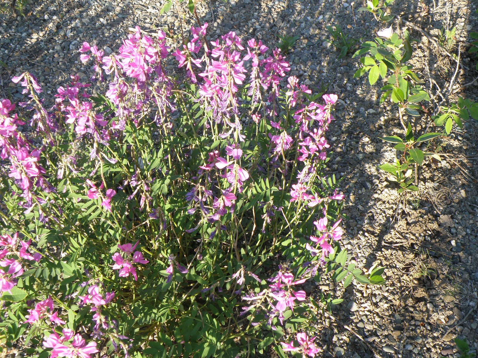
With Diane as my guide and teacher,  I managed to get some wonderful photos of the wildflowers and even learn their names. Mind you, Diane knows the scientific names but these were good enough for me and heaven knows how long I’ll remember them anyway. I loved what Sheila said “We can learn them all over again next year. That way, we’re always learning new things.”

I put them into a special BLOG - firstep Wildflowers – with all the wildflower photos from the Yukon and Waterton to keep all together.

And then, of course there was the Stellar Jay begging some of our lunch.

Waterton-9-27-12 (36)

My Buttons are Popping!

My writing has been coming along – and I did get this email from the editor of one of the magazines I write for:

Top ten Snowbirding 101 articles visited in the last 12 months. (Sept 2011-Sept 2012. Time spent on each article in brackets)

  1. rving across the border (3:39)
  2. feeling down in the dumps (4:29)
  3. going solar harnessing the power of the sun (4:25)
  4. rv park etiquette (3:26)
  5. the ins and outs of rv clubs (3:33)
  6. the vast desert marketplace of Quartzsite (3:53)
  7. the same only different (3:30)
  8. the wonderful world of e-readers (3:50)
  9. show me the money (4:08)
  10. its time for snowbirds to fly home (3:06)

In total Snowbirding 101 received over 7,000 unique page views last year! That is the highest of all our columns. Well done Lynne.


Birds of Prey Refuge Centre

The Centre is about 5 miles east of here and one on those places  I just never got around to visiting, so this year it happened.

The Centre works with injured or abandoned birds. When they’re well or large enough they are release them back into the wild unless they are so badly injured that they would not survive. They do breed burrowing owls because they are an endangered species.

BabyBurrowingOwl

Baby Burrowing Owl

     P8300018   P8300016

These are both Bald Eagles – it can take up to 7 years for the Eagle to develop its while head.

P8300024


The staff work with the birds to demonstrate their power and agility

P8300020

The Ferruginous Hawk – the largest hawk in the world. This one feed mainly of gophers.

Of course, our next big challenge was to plan our Winter Venture.  Originally we wanted to head down to Louisiana and leave here the first of October. A long trip but places we had never been or have not been for over a dozen years – yeh – that sounds like fun!

Then life got in the way. First there was the hurricane, Isaac, that hit around where we wanted to visit – around Lafayette and the wildlife refuge near Lake Charles - and then Fred had a medical incident that turned out okay but took time. Consequently we put off leaving – that is activating the Medical Travel Insurance – until October 20th and our travel plans keep on changing. The only thing that seems consistent is that we will visit New Mexico but not in time for the Albuquerque Balloon Festival.

Back to work!!

We’ll catch up with you somewhere on the road.


Sunday, August 5, 2012

Oh, We Have Your Credit Card

(The whole Yukon Adventure starts with the June 12th Post - http://firstep-andlifegoeson.blogspot.ca/2012/06/going-to-yukon.html )

When I walked into the restaurant at Rancheria, the gal looked at me, reached back on the shelf behind her and said, “Oh, we have your credit Card”. What a wonderful and welcome phrase.

How many places could you leave your credit card; come back five days later; and, not only did they still have your card, they knew it was yours when you walked in?

I started breathing again!!

Instead of retracing our steps back down the Alaska Highway, we hopped onto Highway 1 west and headed towards the Stewart-Cassiar Highway (Highway 37) and Prince George, BC.

Dare I say that the wilderness and scenery along this winding hilly road is more spectacular than along the Alaska Highway?

We started to relax again at Boya Lake Park – a wonderful little campground with intensive blue water reflecting the hills on the other side.

Our site came complete with its own Whiskey-Jack and wildflowers and no rain!

Back on the road, our spirits were lifted and we planned to stop at a couple of First Nations Heritage sites before we left Highway 37 and headed towards civilization.

And then it happened – Boom! After we found a place to pull-off, we discovered that the inside rear tire had blown!

OMG – now what do we do? We have Road-side Service (won’t leave home without it) BUT – how do you contact the Service if there is no telephone or cell serve?

Then folks we had met at the Jade Shop we stopped at pulled-in.

“Got a Problem”? they asked.

After about an hour and a lot of help, we got the spare tire on and went on our way with no spare. (Oh, it had stopped raining for a couple of hours) – so much for exploring anything.

We checked every tire shop in Smithers but they had no tire to match – we got a mismatch in Houston, BC that would do us until be got home.

Well, that’s our Yukon Adventure and it was an Adventure.

We are both glad that we went but (at this point) doubt if we would consider doing it again.

Things I forgot to remember

• Cell phone connections are sparse in unpopulated areas. Be prepared to be out of contact with the outside world for significant blocks of time.

• Also Road Service does little good if you cannot contact them.

• Make sure the tire jack is strong enough to jack up and hold your RV. Carry wood to block up the jack.

• Likely the next place to repair or replace the tire will not have a tire to match.

• Prices of fuel (as well as other things) are significantly higher in remote locations.

• The weather will never co-operate.

• Even though the road is paved, there are potholes big enough to swallow a semi-trailer. Big potholes mean blown tires.

But it was a great trip anyway.

Wednesday, August 1, 2012

Whitehorse and the 2 half days Without Rain


We really didn’t do Whitehorse justice. I know there is a lot to see and do but neither of us where in the mood to explore and enjoy the attractions.

One good thing about travelling in the rain is that it doesn’t take long to pack up and move because we don’t unpack in the first place.

Again we realize just how affected we are by the weather. When the weather is good we tour; find great places and things; and love to explore but come the wind, rain, or snow – both of us tend to fall into a blue funk. That’s what happened in Whitehorse.

It was before noon when we pulled into the Wolf Creek Campground – a Provincial Park just south of Whitehorse. It was cold and rainy and the gentle creek that ran through the park was raging. We unhitched the car and headed for town.

Oh yes, it was raining but we decided to hit the Visitor Information Centres between the rain drops and go in to do the domestic chores (groceries and laundry) the next day.

Our first stop was at the SS Klondike. We never realized that the Sternwheeler would be a Parks Canada Historic Site but it makes sense.

Even before the Europeans came to the North, the Yukon River was the primary travel route. Native tribes moved from one camp site to another during the seasons following the fish and game. Whitehorse would be the site of seasonal fish camps.

Up to 250 wood-powered steam ships travelled up and down the river transporting people, food and supplies. These ships continued to transport freight and passengers until the Klondike Highway (between Whitehorse and Dawson City) was completed in 1950. The S.S. Klondike took cruises up and down the River until 1955 when it took up its present berth as a Historic Site in Whitehorse.

Ah, the next day we woke up to blue skies! Mind you, it was the longest day of the year so we weren’t sure if it was morning or night. Our plan was to do the domestic chores quickly and get on with exploring. Off to the Laundromat.

If you know me at all – you know that doing laundry is my least favourite thing to do – so you know it really needed to be done.

Clothes in the machine and across the lot to grab a coffee. OMG – my credit card was missing! We finally retraced our steps to the last place I used it. Rancheria – I must have left it there. We made a call to MasterCard and they put a hold on the card. We called and called Rancheria but they were not answering the phone.

If we were in a funk before, this put the mud on the cake. Even if the weather was better, we were not happy campers. By the time we straightened out the credit card and the laundry was done, it was raining again. To heck with it, we went off to the local Farmers’ Market anyway to find a couple of friends of friends.

It interests me how some of the most out-of-the-way place attract some of the most out-of-the-ordinary people. Here you have a small city a million miles from anywhere and find people who have migrated there from all over the world. They tell us that they find the inspiration, freedom and camaraderie to spread their wings and do something they had always wanted to do. And yet, you find very few B & R (born and raised) folks there – they want to get out.

Some things just never change.

It was then we decided that we were not having fun and probably wouldn’t until we got my card back or cancelled and the rain stopped. The first seem plausible but the second seemed unlikely as the forecast was for continuing rain for the foreseeable future.

The next day started with blue skies again so we wandered around downtown Whitehorse, took in the live show in the square and got back to the MH before the rain started again.

We left the next morning – in the rain, of course!

Sunday, July 29, 2012

The Yukon . . . A Place like No Other

Click on Photos to Enlarge!!
Like most other places in the North, the greatest attractions in the Yukon are the vast uncompromising wilderness, along with the undaunted animals that graze almost everywhere; the rivers that were critical to transportation of people and goods; and the ever present trees and flowers.

In Watson Lake (considered the gateway to the Yukon) they feature a Space and Science Centre devoted to the Northern Lights (Aurora Borealis) and Canada’s Space Program.

But the most popular place in town is the Sign Post Forest. The forest was started in 1942 by American ALCAN Highway builders (soldiers) pointing out where they came from and how far they were from home. Rumour has it that now there are over 75,000 signs and travelers are encouraged to contribute their own personal sign posts to the forest.

Oh, did I tell you it was raining?

So our stay in Watson Lake was brief.

The next day we moved on searching for the sun.

We didn’t find the sun but we did find a small interesting community at Mile 804 (Km 1244) ofthe Alaska Highway on the shore of the Teslin Lake. With seven trusses, the Nisutlin Bay Bridge takes you to Teslin and is the longest (584 meters / 1917 feet) bridge on the Alaska Highway.

Teslin has one of the largest Native populations in Yukon Territory and First Nations people, the Tlingit, called it Teslintoo, meaning “long narrow water”.

We knew absolutely nothing about the Tlingit People and were surprise to see how similar their cultural is to what we know as the Haida People. It seems that the Tlingit are descents of the Coastal First Nations. A conversation with one of the staff revealed that the Tlingit traveled inland from the coast 200-300 years ago. Many of the Tlingit People retain the hunting and fishing traditions of their people and the intricate masks, needle work and totem pole attest to the many accomplished artists.

Still plagued by rain, mud and road delays we slogged on towards Whitehorse. A stop at Rancheria proved to be most memorable. It is as small compound complete with gas pumps, motel and a few RV sites, all managed out of the restaurant. Apparently, there were all kinds of trucks and vehicles stranded here during the road closures the week before. This was the spot where one of the food trucks going up to Whitehorse opened up the trailer of food to help feed the folks who were stuck there.

As we pulled up to get gas, we noticed a sign on the pump. It said to write down how much gas we pump and take that into the restaurant to pay – and so we did.

But this is also the place I left my credit card in the machine and didn’t realize it until we got to Whitehorse.