Sunday, July 29, 2012

The Yukon . . . A Place like No Other

Click on Photos to Enlarge!!
Like most other places in the North, the greatest attractions in the Yukon are the vast uncompromising wilderness, along with the undaunted animals that graze almost everywhere; the rivers that were critical to transportation of people and goods; and the ever present trees and flowers.

In Watson Lake (considered the gateway to the Yukon) they feature a Space and Science Centre devoted to the Northern Lights (Aurora Borealis) and Canada’s Space Program.

But the most popular place in town is the Sign Post Forest. The forest was started in 1942 by American ALCAN Highway builders (soldiers) pointing out where they came from and how far they were from home. Rumour has it that now there are over 75,000 signs and travelers are encouraged to contribute their own personal sign posts to the forest.

Oh, did I tell you it was raining?

So our stay in Watson Lake was brief.

The next day we moved on searching for the sun.

We didn’t find the sun but we did find a small interesting community at Mile 804 (Km 1244) ofthe Alaska Highway on the shore of the Teslin Lake. With seven trusses, the Nisutlin Bay Bridge takes you to Teslin and is the longest (584 meters / 1917 feet) bridge on the Alaska Highway.

Teslin has one of the largest Native populations in Yukon Territory and First Nations people, the Tlingit, called it Teslintoo, meaning “long narrow water”.

We knew absolutely nothing about the Tlingit People and were surprise to see how similar their cultural is to what we know as the Haida People. It seems that the Tlingit are descents of the Coastal First Nations. A conversation with one of the staff revealed that the Tlingit traveled inland from the coast 200-300 years ago. Many of the Tlingit People retain the hunting and fishing traditions of their people and the intricate masks, needle work and totem pole attest to the many accomplished artists.

Still plagued by rain, mud and road delays we slogged on towards Whitehorse. A stop at Rancheria proved to be most memorable. It is as small compound complete with gas pumps, motel and a few RV sites, all managed out of the restaurant. Apparently, there were all kinds of trucks and vehicles stranded here during the road closures the week before. This was the spot where one of the food trucks going up to Whitehorse opened up the trailer of food to help feed the folks who were stuck there.

As we pulled up to get gas, we noticed a sign on the pump. It said to write down how much gas we pump and take that into the restaurant to pay – and so we did.

But this is also the place I left my credit card in the machine and didn’t realize it until we got to Whitehorse.

Friday, July 13, 2012

Oh Lord did it rain


Click on Photos to Enlarge!!


Of course, we left the Buckinghorse Campground in the rain!

Fred had thought about doing some fishing and hear
d that Muncho Lake was terrific so that was where we headed.

Muncho Lake is long and deep and an intensely emerald green colour. The name came from the Kaska (one of the many First Nation people in Northern B.C. and the Yukon) word for big water. The Lake is a deep, deep jade colour that is often attributed to the copper oxide minerals brought down from the ancient glaciers high above thousands of years ago.

Fishing isn’t much fun when it is cold and rainy so we never did find out if there was good fishing.

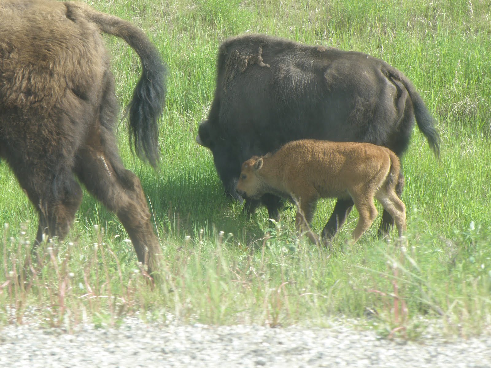
The road from Muncho Lake to Liard is not very far but it seemed lined with expensive tourist stops (a pricey lodge and gas that ran $1.89 a litre) and wildlife – particularly the bison who sauntered along from one side of the road to the other, not paying much attention to any thing or anybody. The fellow at Coal River showed us where the herd of about 200 bison trampled his fence.

Liard Hot Springs is an ecological wonder. There in the northern-most area of western BC approaching the 60th parallel of latitude lies a thermal pool ecosystem - the second largest hot spring in Canada. The temperature of the water ranges from 42°-52° C (107°-126°F) and supports a boreal forest and marsh with species that survive only because of the microclimate the springs produce. The Hot Springs flow directly into an intricate system of swamps. There were two pools but the upper pool (the Beta pool) has been closed to the public to protect an endangered species they discovered in the pond.

A 300 metre wooden boardwalk wanders through the swampy muskeg that supports both wildlife and vegetation that is not found anywhere else.

There is no doubt the Hotsprings was a highlights of our Yukon Adventure. An added element to our joy may have been the weather. The rain let up for the few days we spent there.

We both enjoyed our time there but in different ways. I visited to pool once and Fred enjoyed the healing waters and I spent most of my time wandering around the area taking photos of the wild flowers.

Here are some of the Wildflowers I could identify:


Bluebell


Dandelion-Aster


Arctic Lupine


Bog Violet


Northern Bedstraw


Dogwood-Red Osier

Northern Sweet Vetch


Tundra Rose

Mountain Avens

Wild Strawberry

Prickly Rose


Yellow Lady's Slipper


Forget-me-not

We left the Liard Hotsprings Campground in a flurry of rain warnings but before we left, we did manage to find the Smith River Falls on this dubious trail that wandered up to a couple of outhouses and a questionable view of the falls.


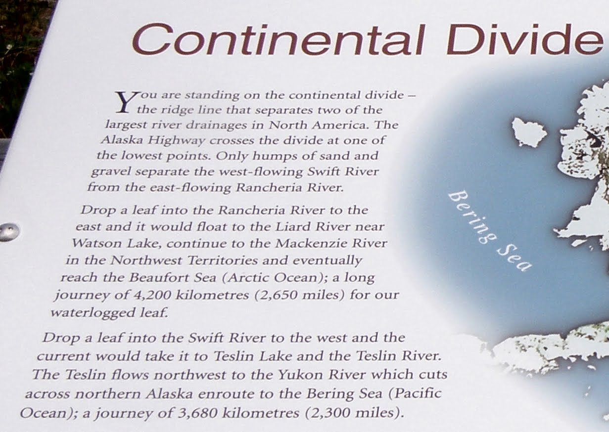
Back on the highway through rain and road wash-outs, we crossed the Continental Divide and made our way into the Yukon and Watson Lake.


Ribbons of snow decorated the mountain peaks all around us.

Sunday, July 1, 2012

Along the Alaska (Alcan Highway) Trail


There it is – kilometre after kilometre of spectacular scenery; raw untouched wilderness surrounding the narrow ribbon of road marking man’s invasion in the pristine frontier of rivers, lakes, wildlife and dense vegetation. If it weren’t for the occasional settlements along the way, it felt like I was on the outside looking in at this vast expanse of nature untouched by human development.

My imagination often got the best of me and as I saw the piles of rocks that extended way up the mountain-side, I envisioned the snow and rocks cascading down from the enormous glaciers that covered the whole area.

It didn’t take much to imagine snow up on the mountains – here it is the middle of June and there are snow-capped peaks all around us.

Nature can be peaceful or she can be violent. It is something that the animals accept but we human seem to be especially affected by the unpredictable changes nature throws at us. The unusually intense run off from the heavy mountain snow-pack this year and the recent rains resulted in slides and washed-out roads. People were stranded all up and down the highway but good stories came out of calamity. Watson Lake and north was running low on supplies and at the Rancheria Cafe, a grocery transport truck opened up his trailer and distributed the food it was carrying.

NEVER have the Motorhome and car been so dirty and muddy.

And you do have to be prepared for any and all eventualities.

Alcan Highway Communities

Each settlement along the way has tales to tell and a walking tour guide to help you navigate the highlights and unique history of the place.

After Dawson at Mile “0” the next settlement is Taylor (Mile 36). It sits on the shore of the Peace River and was the site of treaty signings between the Cree and Beaver First Nations. There was a ferry service across the river until a suspension bridge was built in 1942 but it collapsed in 1957. Rumour has it that Taylor once had an oil refinery but the oil was sent to Edmonton to be re-refined because it did not reach quality standards.

The next sizeable communities are Fort St. John and Fort Nelson. Both have become primary oil field servicing centres are busy and bustling. The only wildlife we saw there were the two legged kind and it was pelting rain. Not my idea of places we wanted to explore, so we moved on (Except Fort St. John’s wonderful City Sani-dump).

We stayed at a small Provincial Campground called Buckinghorse Campground between Fort St. John and Fort Nelson. I was surprised how many rental RV units that were on the road and then realized that most of the travelers are European. We parked next to one couple from Germany and his English was about as good as my German. Through it all, we did manage to find out that they would be in Canada for a few months and that they had flown directly to Whitehorse from Frankfurt.

He did coined one phrase I thought should be put on a bumper sticker Adventure before Dementia. What do you think?

The Real Wildlife

Most of the Northern Wildlife is certainly willing to share their space with the many tourists that wander up and down the pavement in and amongst their homes. Here in the middle of June (before the Summer Solstice) the animals were just shedding their winter coats and the babies with their Moms had recently joined the herds.

Many of the animals have become VERY human savvy as they travel along the roads and invade the camp grounds.

My Sighting of a Moose!


The funniest sign was the one that said CAUTION: Watch for Moose for the next 88 km.

Why 88 km? I never did figure it out.

To Be Continued

Tuesday, June 12, 2012

Going to the Yukon

We got packed up and left June 5th. The first few days were rainy but we spent them with Chuck and Sheila in Wetaskiwin. We travel with them often and enjoy their company so the rain didn’t bother us much – wonderful friends, wonderful company and wonderful food.
Sheila and I got into cooking while we were there. We created a few terrific meals and made some Salsa and Rhubarb preserves. We capped that off by finding an outstanding Greek restaurant in their little town – do we travel on our stomachs or what?
Not to overstay our welcome, we left on Sunday and travelled onto Grand Prairie where it was raining. The last time we were in Grande Prairie was in the late 70s when we had just come west from Cape Breton. We were looking for a place to settle. It is nothing like it was then (wooden sidewalks and mud) but now it is fast and furious (big malls filled with the same stores as everywhere else and drivers who are in a colossal hurry to get somewhere). It was still raining so we just stayed there overnight and kept going. Need I say, I would not want to settle in Grande Prairie now anymore than I did the first time we were there.
Dawson Creek
As we pulled into Dawson Creek – Mile “0” of the Alaska Highway - we stopped at the Visitor Information Centre and were told that there was no sense going any further for a few days because the roads around Watson Lake in the Yukon were flooded out and they were running low on supplies. Watson Lake requested that folks not venture further north until the roads were passable and they could restock.

The town was crowded with people anxious to get going north. No problem for us, we were in no hurry, so we found Kiskatinaw Provincial Park and set up to stay for a few days. The park is on the old Alaska Highway about 28 km north of Dawson Creek beside the Kiskatinaw River.
clip_image004
clip_image006
The river winds in and out and around and at a strategic spot at Mile 20 on the original highway, it makes a sharp hairpin turn just where the highway crossed the river. This called for the construction of a bridge and they constructed a 190 foot curved wooden bridge that has a 9 degree grade to conform to the bend of the highway.
clip_image008It was the first curved wooden bridge built in Canada and one of the few remaining structures of its type.
Dawson Creek’s original claim to fame was that it was the end of the Northern railway line. Now that isn’t entirely true because they moved the whole town two miles to be beside the track. Then in 1942 the Americans decided they needed an overland road to protect the Aleutian Islands and connect the lower 48 States to Alaska. Dawson Creek then became MILE “0” of the Alaska (ALCAN) Highway. For those of us who didn’t know, the ALCAN (Alaska Highway) was over 1500 miles from Dawson Creek to Delta Junction, Alaska and was completed in 8 months and 12 days!
Dawson Creek has done a great job promoting its own history as well as the distinction of being the beginning of the Alaska Highway.
clip_image010

clip_image012
The Alaska Highway House is in the middle of downtown Dawson Creek at the junction where the Mile “0”cairn stands. The House is filled with stories, memorabilia, and pictures of the building of the road and the men who built it.
clip_image014
clip_image016
Many of the soldiers who worked on the road were Afro-American and had never felt cold weather, let alone seen the mountains of snow and trees that surrounded them. Dawson Creek was the end of their train ride and from there on; there was nothing but forests, trees, mountains and cold. A PBS documentary helps travelers appreciate what the builders endured over those 8 months.
clip_image018
A walking tour of the town takes you from the Visitor Centre complex at the old Railway Station to the downtown area. Local artists have been commissioned to paint wall murals throughout the area that picture various streets, buildings and characters from Dawson Creek’s past.
clip_image020
clip_image022
clip_image024
They got the road open so we set off to Fort St. John and beyond.