Thursday, February 25, 2010

Finding Joshua Tree - Remembering the Sneaker Tree

**********************************

Double Click on photos to enlarge

*********************************

'Jacob's Tails' soon to be published as an E-Book

*********************************


Our plan was to go to Joshua Tree NP and/or Borrego Springs from here so we decided to do some site and trail scouting before we moved. Off we went into California along Interstate 10 and realized we’d never been west of Blythe on this road before. One the map, it looked like the next major spot was Desert Center – a good place to stop. Only the signs on the road said that there were no services for 60 miles and Desert Center was only 30 miles. The road signs must be wrong, right?

Yeh, we’re going to check it out anyway. The signs were not wrong! Really, there was nothing there. Now, that’s not entirely true. The first thing we came across was dozens upon dozens of dead palm trees lying stretched out along the sides of the entrance road to the town. A town that looked totally abandoned – another Ghost Town wanna-be.

We kept going along Highway 177 and found out there was very little else. A couple of roads went off to parts unknown: one was the Kaiser Road; the other was a road that led to Lake Tamarisk Desert Resort. What the heck – we went off to Lake Tamarisk. Our first sighting was four ladies doing their morning walk along the road. Then we came to a road, not unlike every other road that takes you to a private community, and turned in. We entered an exclusive-looking community with their own Fire Department, Golf Course and street after street of houses, park model trailer and RV’s (some 150 lots).

We stopped in at the office to get the scoop on the place. Apparently there had been a large mine owned and operated by Kaiser Industries (thus the Kaiser Road) and they had built the Resort as a retreat for their executives. When the mine closed, the Resort was bought out and became an “active senior community”, as the brochure calls it.

Curiosity satisfied we went back to Interstate 10 and onto the next stop at Chiriaco Summit – the site of the General Patton Memorial Museum and a route we had been on before with Anne and Eldon. This was the area where Patton set up a training center for the American troops being readied for battle in North Africa during the Second Word War.

The Chiriaco family set up house, home and services there just after the First World War. They were responsible for getting the General Patton Museum established and to this day, the family operate the restaurant and services.

Joshua Tree National Park covers almost 800,000 acres in both the Colorado and Mojave Deserts. According to the gal at the Visitor Center, Joshua Trees only grow in the Mojave at a higher altitude. You see very few travelling the main road of the park because it is mainly in the Colorado Desert.

The Joshua Tree is not a tree! In fact, it is not even a cactus. The Joshua Tree is part of the Yucca family which is part of the Lily family. The Natives recognized the value of the Tree and were known to use the leaves for baskets and sandals and the blooms and seeds for their nutritional qualities. Word has it that on their trek westward, the Mormons encountered the tree and named it the Joshua Tree because of its seemingly outstretched arms.

To me, one of the most fascinating features in the park is what they call the Rockpiles”. What you see are these huge, smooth boulders that sit one on top of the other.

Hundreds of millions of years ago hot lava repeatedly oozed up through the surface of the earth and cooled. Over time one surface bubbled up and built on the last one. The wind and water eventually eroded away the soft rocks and vertical fissions or joints were created. The moisture seeped down through the cracks and the formations became almost rectangular. Some of the hard minerals were transformed into soft clay and others loosened and drifted down. Wind and water are forever constant and constantly attack the rocks to create the rounded smooth surfaces of the boulders. There are places out there that look like God took a massive dump in the middle of a huge flat.

The perfectly balanced 800 pound moving GeoKenetic sculpture at the Twenty-nine Palms Visitor Center reminds us that “all relationships are at best delicate and everlasting change.”


Remembering the Sneaker Tree


Way back in 2001 when we travelled with Anne and Eldon, we came across a couple of strange phenomena: the rock graffiti on the banks leading up to the bed of the train tracks and the Sneaker Tree. And there they were on Route 62, west of Vidal Junction on the way to Parker.


Graffiti found – Sneaker Tree, gone!


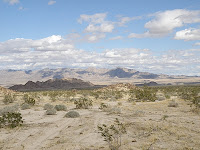
This whole experience was so surreal: from the rows of dead palm trees; to the resort to the rock piles in the middle of Joshu a Tree NP; to finding the Railway Graffiti and not finding the Sneaker Tree; and finally how everything looked and felt like we were

living in a landscape painting.


Tuesday, February 23, 2010

Yuma is Yuma is Yuma is Yuma!

Yuma tends to be shopping and eating and eating and shopping and maybe more eating. I seem to do a lot of that since I quit smoking. It’s not that food tastes so much better; it’s just that I need something that continually goes from my hand to my mouth. It can be almost anything. I started out being so-o-o good munching on celery but do you know how boring celery can get? I still can’t think of anything that has as few calories as celery and so the pants get tighter.

Anyway three weeks in Yuma was enough. We can’t complain: Sallee and John are great friends (and they tried to teach us pinochle – mission impossible); our site in the Foothills is in a great neighbourhood, but you know how we are about cities! Doing Laundry twice was enough to encourage us to leave!!

We spent our travel time going out to Holtville and the Imperial Valley in California and, of course, down to Algodones, Mexico.

We stopped at the BLM near Holtville called the Oasis Desert Hot Springs to meet with George and Gaylene, folk we met a couple of years ago. There is a core of Canadian Snowbird residents mainly from Alberta and BC but some like George and Gaylene make an annual trek from Ontario. Like any gathering of people they have formed various groups and you see rings of RVs around big fire pits where they meet for nightly get-togethers.

The main attraction here is a mineral hot springs. The Springs are accessible to all. The temperature is about 120 degrees F and people claim there are healing properties. All I know is that it feels great. The people from Holtville (a nearby town) and the BLM residents have worked together to build and maintain the Hot Springs area to keep it clean and free of charge for everyone.


There are showers you can stand under – no soaps allowed; there is a pond surrounded by palm trees that isn’t as hot for swimming; a hot, hot tub; and a not so hot tub.


The water was so hot people go down, fill up containers and bring them back to do dishes and laundry.


After all these years, we finally got the chance to be in Holtville for the Carrot Festival. Unfortunately, it was cold and rainy but, damn we went anyway!!


Algodones seems to be getting a little more sophisticated. Some of the merchandise might be China-made most is still comes in from various parts of Mexico and Central America and no matter what – the people are charming.


Our favourite taco place has new signs and table clothes but still great food (at a great price).


We’re back in Quartzsite now for a couple of weeks.