Sunday, July 1, 2012

Along the Alaska (Alcan Highway) Trail


There it is – kilometre after kilometre of spectacular scenery; raw untouched wilderness surrounding the narrow ribbon of road marking man’s invasion in the pristine frontier of rivers, lakes, wildlife and dense vegetation. If it weren’t for the occasional settlements along the way, it felt like I was on the outside looking in at this vast expanse of nature untouched by human development.

My imagination often got the best of me and as I saw the piles of rocks that extended way up the mountain-side, I envisioned the snow and rocks cascading down from the enormous glaciers that covered the whole area.

It didn’t take much to imagine snow up on the mountains – here it is the middle of June and there are snow-capped peaks all around us.

Nature can be peaceful or she can be violent. It is something that the animals accept but we human seem to be especially affected by the unpredictable changes nature throws at us. The unusually intense run off from the heavy mountain snow-pack this year and the recent rains resulted in slides and washed-out roads. People were stranded all up and down the highway but good stories came out of calamity. Watson Lake and north was running low on supplies and at the Rancheria Cafe, a grocery transport truck opened up his trailer and distributed the food it was carrying.

NEVER have the Motorhome and car been so dirty and muddy.

And you do have to be prepared for any and all eventualities.

Alcan Highway Communities

Each settlement along the way has tales to tell and a walking tour guide to help you navigate the highlights and unique history of the place.

After Dawson at Mile “0” the next settlement is Taylor (Mile 36). It sits on the shore of the Peace River and was the site of treaty signings between the Cree and Beaver First Nations. There was a ferry service across the river until a suspension bridge was built in 1942 but it collapsed in 1957. Rumour has it that Taylor once had an oil refinery but the oil was sent to Edmonton to be re-refined because it did not reach quality standards.

The next sizeable communities are Fort St. John and Fort Nelson. Both have become primary oil field servicing centres are busy and bustling. The only wildlife we saw there were the two legged kind and it was pelting rain. Not my idea of places we wanted to explore, so we moved on (Except Fort St. John’s wonderful City Sani-dump).

We stayed at a small Provincial Campground called Buckinghorse Campground between Fort St. John and Fort Nelson. I was surprised how many rental RV units that were on the road and then realized that most of the travelers are European. We parked next to one couple from Germany and his English was about as good as my German. Through it all, we did manage to find out that they would be in Canada for a few months and that they had flown directly to Whitehorse from Frankfurt.

He did coined one phrase I thought should be put on a bumper sticker Adventure before Dementia. What do you think?

The Real Wildlife

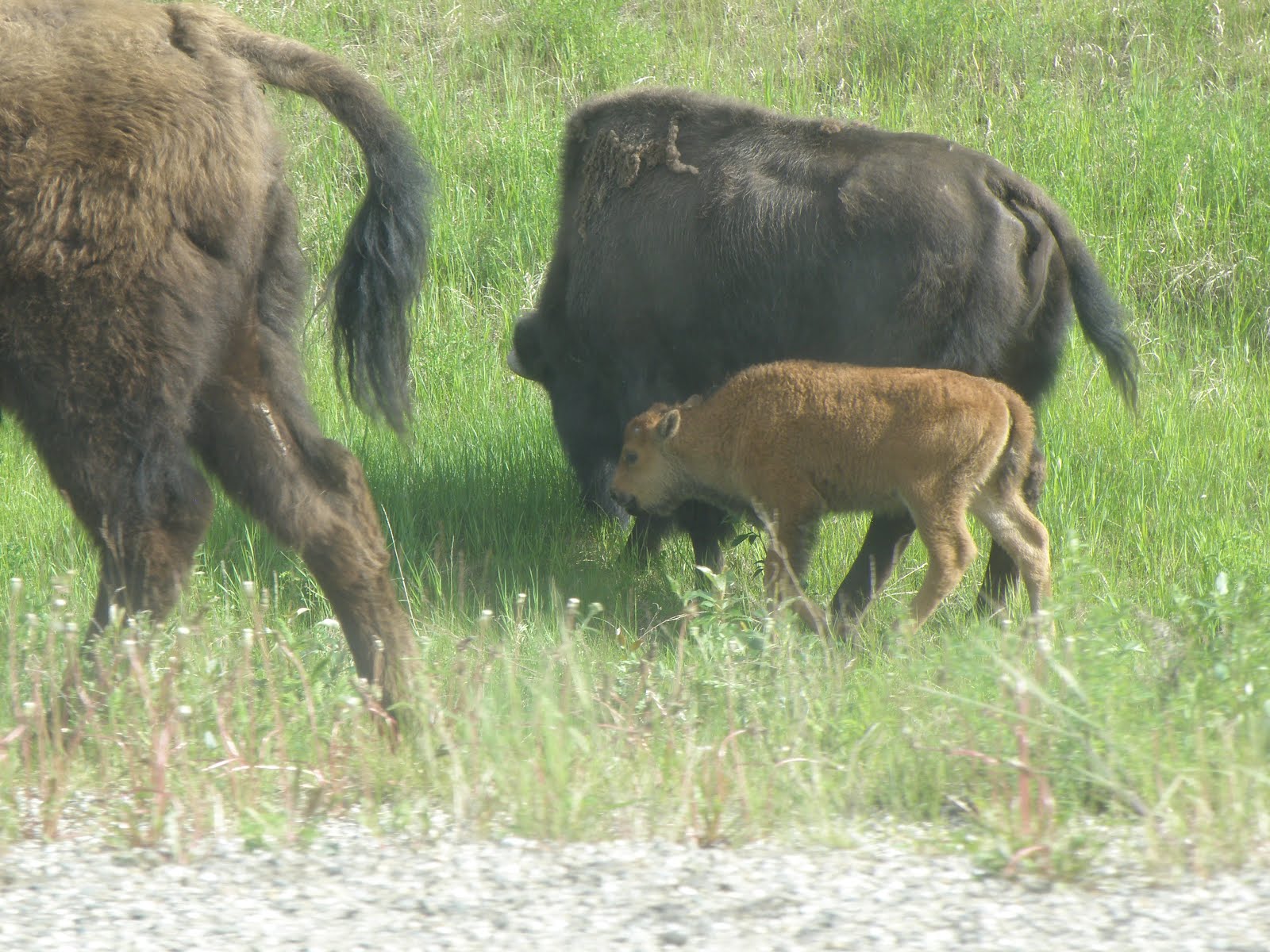
Most of the Northern Wildlife is certainly willing to share their space with the many tourists that wander up and down the pavement in and amongst their homes. Here in the middle of June (before the Summer Solstice) the animals were just shedding their winter coats and the babies with their Moms had recently joined the herds.

Many of the animals have become VERY human savvy as they travel along the roads and invade the camp grounds.

My Sighting of a Moose!


The funniest sign was the one that said CAUTION: Watch for Moose for the next 88 km.

Why 88 km? I never did figure it out.

To Be Continued

Tuesday, June 12, 2012

Going to the Yukon

We got packed up and left June 5th. The first few days were rainy but we spent them with Chuck and Sheila in Wetaskiwin. We travel with them often and enjoy their company so the rain didn’t bother us much – wonderful friends, wonderful company and wonderful food.
Sheila and I got into cooking while we were there. We created a few terrific meals and made some Salsa and Rhubarb preserves. We capped that off by finding an outstanding Greek restaurant in their little town – do we travel on our stomachs or what?
Not to overstay our welcome, we left on Sunday and travelled onto Grand Prairie where it was raining. The last time we were in Grande Prairie was in the late 70s when we had just come west from Cape Breton. We were looking for a place to settle. It is nothing like it was then (wooden sidewalks and mud) but now it is fast and furious (big malls filled with the same stores as everywhere else and drivers who are in a colossal hurry to get somewhere). It was still raining so we just stayed there overnight and kept going. Need I say, I would not want to settle in Grande Prairie now anymore than I did the first time we were there.
Dawson Creek
As we pulled into Dawson Creek – Mile “0” of the Alaska Highway - we stopped at the Visitor Information Centre and were told that there was no sense going any further for a few days because the roads around Watson Lake in the Yukon were flooded out and they were running low on supplies. Watson Lake requested that folks not venture further north until the roads were passable and they could restock.

The town was crowded with people anxious to get going north. No problem for us, we were in no hurry, so we found Kiskatinaw Provincial Park and set up to stay for a few days. The park is on the old Alaska Highway about 28 km north of Dawson Creek beside the Kiskatinaw River.
clip_image004
clip_image006
The river winds in and out and around and at a strategic spot at Mile 20 on the original highway, it makes a sharp hairpin turn just where the highway crossed the river. This called for the construction of a bridge and they constructed a 190 foot curved wooden bridge that has a 9 degree grade to conform to the bend of the highway.
clip_image008It was the first curved wooden bridge built in Canada and one of the few remaining structures of its type.
Dawson Creek’s original claim to fame was that it was the end of the Northern railway line. Now that isn’t entirely true because they moved the whole town two miles to be beside the track. Then in 1942 the Americans decided they needed an overland road to protect the Aleutian Islands and connect the lower 48 States to Alaska. Dawson Creek then became MILE “0” of the Alaska (ALCAN) Highway. For those of us who didn’t know, the ALCAN (Alaska Highway) was over 1500 miles from Dawson Creek to Delta Junction, Alaska and was completed in 8 months and 12 days!
Dawson Creek has done a great job promoting its own history as well as the distinction of being the beginning of the Alaska Highway.
clip_image010

clip_image012
The Alaska Highway House is in the middle of downtown Dawson Creek at the junction where the Mile “0”cairn stands. The House is filled with stories, memorabilia, and pictures of the building of the road and the men who built it.
clip_image014
clip_image016
Many of the soldiers who worked on the road were Afro-American and had never felt cold weather, let alone seen the mountains of snow and trees that surrounded them. Dawson Creek was the end of their train ride and from there on; there was nothing but forests, trees, mountains and cold. A PBS documentary helps travelers appreciate what the builders endured over those 8 months.
clip_image018
A walking tour of the town takes you from the Visitor Centre complex at the old Railway Station to the downtown area. Local artists have been commissioned to paint wall murals throughout the area that picture various streets, buildings and characters from Dawson Creek’s past.
clip_image020
clip_image022
clip_image024
They got the road open so we set off to Fort St. John and beyond.

Friday, June 1, 2012

It Was Poopy Spring So We Are Going to the Yukon

Yeh, it was a poopy spring. Actually, it started even before spring when the friend of a friend took a nose-dive over the front on his Quad and didn’t live to tell the story. Now, that was an anomaly but not terribly surprising. He lived his life on the edge and sort-of fell off.
A little over a week after we got home, one of our favourite people – the fellow who edited Jacob’s Tails and with his wife, checked our condo and collected our mail when we were away – had a massive stroke and never recovered.

Then my 38 year old nephew had a heart attack and then Alice, the gal that was the centre of the RV Writers’ group I belonged to and who encouraged my writing, was found dead in her Motor Home. Another friend had a massive stroke and

Fred ended up in Emerg with a terrible pain in his head. He underwent every test imaginable and they couldn’t find anything crucial – that is no tumour and his heart was fine but his own doctor took umpteen x-rays and thought it could well be a pinched nerve in his neck/spine – not nice but a fairly good explanation.

My brother says that (at our age) there is a pandemic of these things and right he is, unfortunately, it is not going to stop.

It’s not the getting older that bothers me; it is loosing all my friends. With that out and said - - we decided not to stick around Lethbridge and are on our way to the Yukon.

Saturday, March 31, 2012

Chiricahua National Monument: An Other-Planet Experience

It’s so difficult to describe Chiricahua National Monument. I was sure we had left planet Earth and travelled out somewhere far, far away in another galaxy.

The Park sits in Cochise County in the South-East corner of Arizona. The diversity is unmatchable. To get there, you travel along a valley floor through fairly desolate prairie lands (especially this time of year) to the gateway of the Chiricahua Mountains.

The Faraway Ranch sits between the Gate and the Visitor Center and is worth a look-around to understand how this area developed and then became a tourist destination.

Beyond the Center, Bonita Canyon winds through all sorts of rock formations. They call the park the Wonderland of Rocks and as you travel along, you can understand where that name came from.

Columns and pinnacles of rock rise skyward out from  the vegetation.

01

00

These huge, vertical structures were (and continue to be)created from erosion penetrating joints in the soft volcanic rocks.

Travelling further into the park, the view expands and widened and you get a different picture of the extraordinary power and beauty of Nature.

02

04

03

06

05

Chiricahua was certainly one of the highlights of our 2011-2012 Winter.

Friday, March 16, 2012

Spring has sprung, the grass is ris: I wonder where da birdies is

The Why/Ajo, AZ area did not meet our expectations for bird watching or even stalking the wild flowers. We did see some old bird friends and some old human friends (Tracy and Stan were on the other side of another wash and Chuck and Sheila were parked out behind Ajo) but we were quite disappointed in the bird watching.

phainopepla-male-edited phainopepla-female-edited

male phainopepla female phainopepla

Road-runner (13)edited

Road-runner

Our rule of thumb has been to move on when our waste tanks are full – but this time we didn’t wait because Why came under a GREAT WIND STORM threat so we headed towards Tucson. Well we did not miss the dust entirely - the MH and the car were covered with dust from one end to the other.
The only pavement we knew about was the Casino but that didn’t satisfy the spring-fever bug to find the illusive birds. Our thought was to go down to Patagonia but decided to check into the Escapees RV Park at Benson (Saguaro Co-op) to get out from underneath all the dust and dirt and venture out on day trips from there.

The Escapees Park at Benson is much bigger than we are used to and very resortish which we are also not used to but it served its purpose and gave us a non-dusty place to vacuum, clean and explore places we had not seen at all or at least not in the past 7-8 years.

P3050001

BTW – this shrub was on our site and I have no idea what it is. Can anyone out there help me identify it?

P3050004

IMG_4963Our first venture was to the Patagonia area – a place noted for viewing birds. We followed Highway 83 to Sonoita and then down to Patagonia. Spring hadn’t quite arrived there yet (a rather bleak, hilly trail not unlike our prairies to foothills in the late fall). We were surprised to learn they are promoting wine and vineyards in this area. Mind you, we didn’t see any sign of grapes growing – the best sign we saw was the Welcome sign for Sonoita.

We had been to Patagonia before but that was about eight years ago. There always was a bird-watching mood about the area but it now seems to have become a haven for artists, as well as the birders. We visited the State Park but we were too early for some and late for others to see many birds so we stopped at Pattons Hummingbird Haven.

What used to be a private home is now open to the public. Unfortunately a Red-tailed Hawk arrived just before we did and there was a mass exodus of the majority of smaller birds. We stuck around for a while, but only saw a couple of interesting friends.

The Gila Woodpecker is the clown of the bird kingdom. Here he was after the suet but we’ve seen them upside down trying to drinking out of the hummingbird feeder.

CARDINAL-EDIT (2)

Cardinal

GilaWoodpecker

Gila Woodpecker

Onto the San Pedro House (Riparian National Conservation Area) and a wonderful place to wander, sit and watch all the activity.

P3040001 P3040015 Cardinal2

IMG_5015

The most outstanding venture we took was to the Chiricahua National Monument – the Wonderland of Rocks.

Even with all the Geological marvels we have seen – the Chiricahuas are by far the most extraordinary. So spectacular that they deserve a separate BLOG entry (this will come later).

We left some sights unseen (for next time) and wandered up to Casa Grande for one last visit before we started our meandering northern trek.

Next stop – Quartzsite and High Jolly.

Wednesday, February 22, 2012

Our Love-Hate Relationship with Yuma

From Casa Grande, we met Sheila and Chuck for a few days on Darby Wells Road – the trail that circles around the mine at Ajo.

Fred, Chuck and Sheila went out exploring the road and found this interesting Cemetery they said was Mexican.

DarbyWellsCenetary (2)

DarbyWellsCenetary (5) 

DarbyWellsCenetary (4)

We had been told about a place in Sells, (the centre of the Tohono O’odham Nation) that served traditional Tohono O’odham food and finally found the Desert Rain Cafe. As Betty said “Every item on the menu has at least one ingredient which has been part of the traditional Tohono O'odham culture. Hummus made using tepary beans, agave used as sweetener. My favourites were the dark tepary bean hummus and the Cholla bud Salsa: Fred liked the Prickly Pear salad dressing. Different and delicious.

Organ Pipe Cactus National Monument

We took the van tour again. This time our guide was Sardius – otherwise known as Ranger Rick because nobody could pronounce his name, His passion is the cacti and he managed to find ever so many anomalies for us to o-o-o-o and aw-aw-aw over.

P1160017    

DSCF0002

P1150002

P1160018

There is an abundance of cacti up around Ajo and the mine but there was little other vegetation and therefore, wild-life or birds. I think I like the Why area better though

Our Love-Hate Relationship with Yuma

We have an interesting Love/Hate relationship with Yuma: we keep going back and we keep leaving!

Mostly, we are drawn there by the best winter weather in the US Southwest; some exceptionally good friends; an easy trip to Algodones, Mexico; good shopping; and an Escapees Co-op Park that offers good spaces, good laundry; good people and a great hot tub.

On the other hand, we have been there so often and toured the area so much, there is not much new to find. As  Sheila says, we’ve just seen too much. So, after we spend good quality time with friends; do our Algodones thing; shop ourselves out (or run out of space-whichever comes first); and spent too much time in the casinos; we are ready to leave the city.

Well, the four of us (Sheila, Chuck, Fred and me) headed off to California and Ogilby Road.

And we thought we had done our visiting!!

First we got a phone call from Don and Jan saying that Jan had fallen and broke her ankle so we wanted to visit them while they were still around. Then Stan and Tracy, a couple we met at the RV Lifestyle Seminars in Kelowna some eight or nine years ago – then they came out. Then an email from Colleen and Marc, new RVers we first met in Casa  Grande a month or so ago; then Judy and Terry emailed that they were coming out!!

Busy, busy busy – it’s tough to have quality time with so much company and it’s nice to have friends that you can tell that you just can’t take so many people all at one time and they understand and are not offended!

While we were out there, Chuck and Sheila got the sad news that a friend of theirs had been killed in an ATV accident near Florence, AZ.

We consoled ourselves by finding one of the finest Mexican buffets I have experienced. We did a day trip up towards Indio, CA did a bit of casino hopping and came back pleased; stuffed; and readily comforted.

Our rule-of-thumb (when we are dry camping) is to move when the waste tanks are full and that usually takes around 7 to 10 days  - Our next move was back to Casa Grande for a massive clean-up; re-energize; and re-stocking.

So now we are back at Why and feeling somewhat liberated. We’ve only been here for a couple of days and Fred has been out taking pictures and I have been working on this post and enjoying watching the birds and little wild things.